Interactive Groundwater Map
Explore groundwater monitoring across the Vina and Wyandotte Creek Subbasins using this interactive map. View the locations of monitoring wells, stream gages, and other key features, and turn layers on and off to see how groundwater conditions are tracked across the region.
Link to web map: Vina & Wyandotte Creek Subbasins Public Web Map
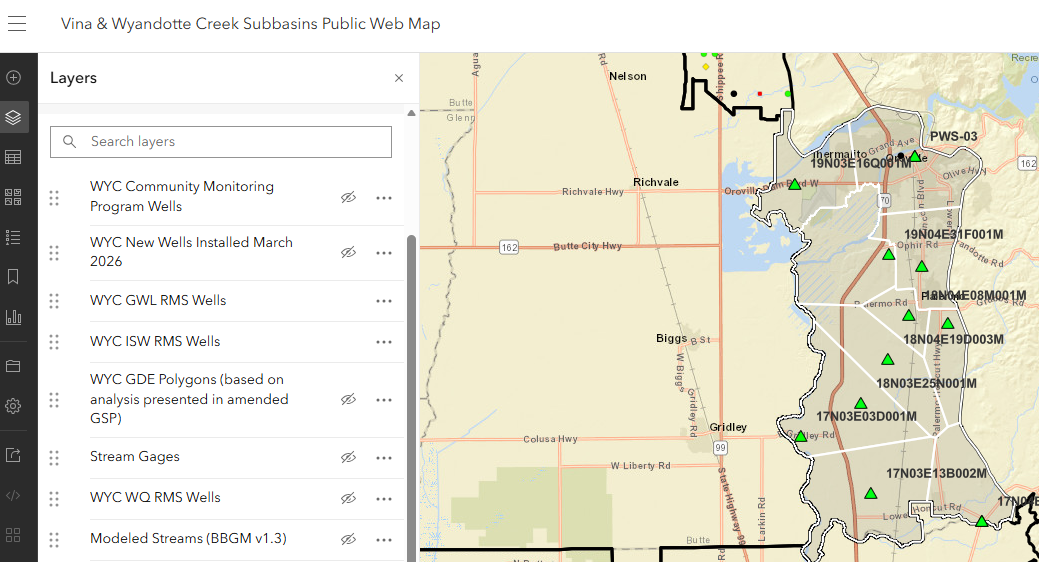
To explore different layers on the Vina & Wyandotte Creek Subbasins Public Web Map, you can toggle data layers on and off using the Layers panel on the left side of your screen, as pictured below. Each layer represents a specific dataset—such as monitoring wells or stream gages—and is accompanied by an eye icon. To show or hide a specific layer, click the eye icon next to its name; a slashed eye indicates the layer is hidden, while a clear eye means it is visible on the map. This feature allows you to customize your view and focus on the specific water resources and infrastructure data most relevant to you.